"A catchment is an area of land from which water drains into a river. Every part of the earth's land surface is part of a catchment. Neighbouring catchments are divided by watersheds, and rivers are arranged within catchments in drainage patterns."
A catchment (or drainage basin) is an area where water is collected by the natural landscape. When precipitation (snow, hail, rain) falls to the ground, water moves over the land and finds its way into streams or down into the ground.
Imagine cupping your hands in a downpour of rain and collecting water in them. Your hands have become a catchment. The outside edge of a catchment is always the highest point. Gravity causes all rain and run-off in the catchment to run downhill where it naturally collects in creeks, rivers, lakes or oceans. Rain falling outside the edge of one catchment is falling on a different catchment, and will flow into other creeks and rivers.
Some water also seeps below ground where it is stored in the soil or in the space between rocks. This is called groundwater.
We use the water collected by the natural landscape to help supply water for our needs, by building dams and weirs, or tapping into groundwater.
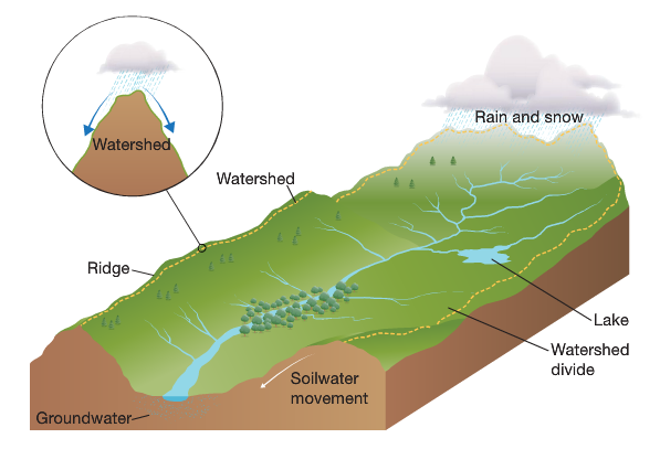
A watershed is the point at which precipitation falls and flows into either one or two neighbouring water catchments.
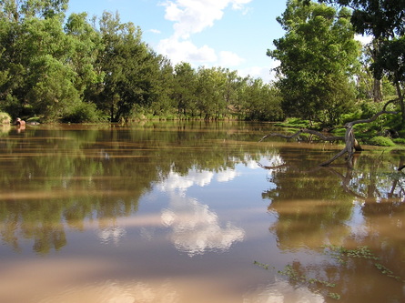
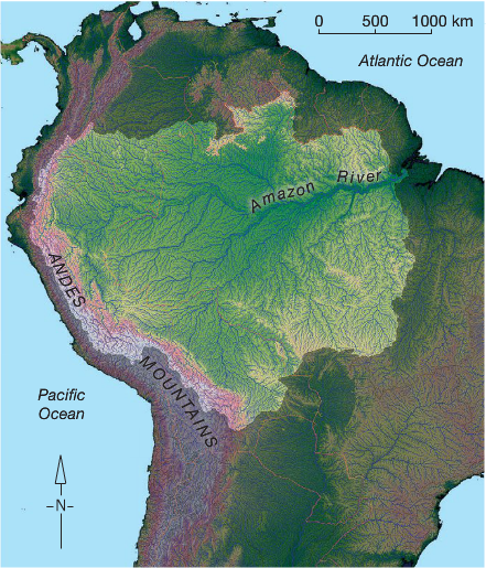
Catchments vary in size and overall area that they cover. They range from small urban or coastal catchments to catchments covering thousands of square kilometres:
|
|
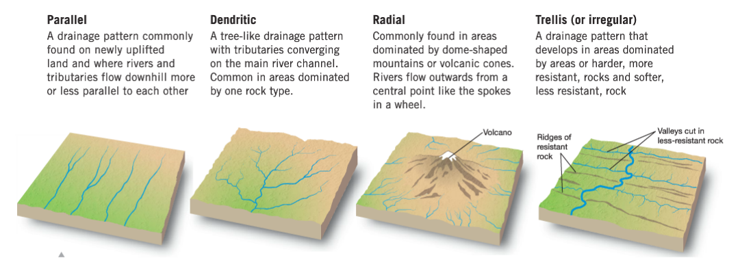
A drainage system are the patterns formed by the streams, rivers, and lakes in a particular drainage basin. They are governed by the topography (shape) of the land, whether a particular region is dominated by hard or soft rocks, and the gradient (steepness) of the land.
There are four main types of drainage patterns:
There are four main types of drainage patterns:
Check out this article about Perth's catchment areas and then watch the video below:
Complete these questions in your work book:
- Explain the difference between a catchment and a watershed
- Why are catchments important?
- Why do rivers continue to flow even when it has stopped raining?
- Draw a diagram of each of the four drainage patterns: parallel, dendritic, radial and trellis
- Complete the interactive activity on page 109 of Pearson
